Everything You Need to Know Before Traveling to Torres del Paine
Planning and Best Season
There are daily seasonal buses connecting Puerto Natales with Laguna Amarga, Serrano and Pudeto, plus private transfers. The trip takes around 2 hours. Full details here:
https://torresdelpaine.com/en/torres-del-paine-2/useful-tips/how-to-get-to/#
https://torresdelpaine.com/en/transfer/puerto-natales-bus-terminal-torres-del-paine/
Torres del Paine National Park has three main entrances:
Laguna Amarga,
Serrano,
Lago Sarmiento.
The choice of entrance will depend on the itinerary or sector you plan to visit.
For example:
If you are traveling to the Las Torres sector to hike to Base Torres, visit Cuernos, or start the O Circuit, the recommended entrance is Laguna Amarga.
For excursions or boat trips in the Grey or Pehoé sector, we suggest entering through Serrano or Lago Sarmiento.
You can check the complete map and access details in our guide to Entrances and Access to Torres del Paine National Park.
Yes, there is no free public transportation within Torres del Paine National Park, but there are regular services connecting the main sectors and gatehouses.
You will find:
Buses connecting Puerto Natales ⇄ Laguna Amarga / Pudeto / Administration.
Shuttle between Laguna Amarga and the Las Torres Welcome Center.
Catamaran on Lake Pehoé, connecting Pudeto with Paine Grande, widely used by those doing the W Trek.
Check schedules, routes, and mobility tips in the section How to get around inside the park.
Yes, you can drive around Torres del Paine, which is an excellent way to explore the park at your own pace, stopping at viewpoints and natural areas.
The roads are gravel and mostly passable year-round, although some sections—such as the one connecting Administración with Hotel Lago Grey—are less well maintained and require caution.
Check out recommendations, road conditions, and safe driving tips in the guide Torres del Paine by car: yes, you can.
The best time depends on the type of experience you are looking for.
High season (October to April): longer daylight hours, more stable weather, and all services operational; ideal for doing the W, O, and classic excursions.
Mid-season (October–November and March–April): fewer visitors, intense colors, and good weather conditions.
Winter (May to September): very few visitors, several services closed, and more challenging weather, but incredible landscapes under the snow.
Always check the forecast and trail conditions before your visit.
In 3 or 4 days, you can visit the most iconic viewpoints, such as Cuernos del Paine, Grey Lake, Salto Grande, wildlife viewpoints, and Base Torres (weather permitting).
For trekking:
W Trek: 4–5 days.
O Circuit: 7–9 days.
The total time will depend on your pace, weather, and type of accommodation.
Yes, if you are going to spend the night on the W or O circuits, you must book each night of camping, shelter, or campsite in advance; it is mandatory to enter the park. The eastern sectors (Central, Chileno, Cuernos) are booked with Las Torres Patagonia, and the western sectors (Paine Grande, Grey, Dickson, Los Perros) with Vértice Patagonia. For day visits, your valid ticket is sufficient. Our experts can help you with the reservation.
You can purchase official tickets to Torres del Paine National Park online, through the CONAF website or directly from our portal in the Tickets and Access to Torres del Paine National Park section.
On that page, you will find step-by-step instructions for purchasing tickets online, updated prices, the validation process at the gate, and recommendations for entry based on your date and type of visit.
Important: tickets are not sold in cash inside the park; purchases must be made in advance and the QR code must be presented upon entry.
Circuits and trekking
There are daily buses during the season connecting Puerto Natales with the Laguna Amarga and Serrano / Pudeto gates, as well as private services. The trip takes approximately 2 hours, depending on conditions. Details and providers are available at How to get there.
The main entrances are Laguna Amarga, Serrano, and Lago Sarmiento. Choose based on your itinerary (Torres Base, Grey Navigation, Pehoé area, etc.).
There is no on-demand public transportation, but there are connecting buses to key points at fixed times (e.g., Puerto Natales ⇄ Porterías), a shuttle between Laguna Amarga and the Las Torres Welcome Center, and the catamaran that crosses Lake Pehoé between Pudeto and Paine Grande (widely used for the W). See options in Getting Around.
Circuits and Trekking
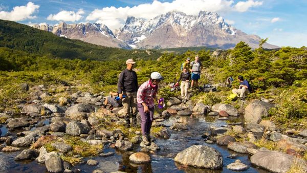
All three are the most iconic treks in Torres del Paine National Park, but they vary in duration, difficulty, and type of experience:
W Circuit: covers the Grey, French, and Base Torres valleys. It lasts between 4 and 5 days, with established shelters and campsites. Ideal for those looking for the essentials of the park.
Circuit O: completely circles the Paine massif, including the John Gardner Pass. It lasts 7 to 9 days, is more demanding, and offers a more challenging experience.
Hike to Base Torres: a one-day excursion from the Las Torres sector, with a demanding ascent and panoramic views of the iconic granite towers.
Find out which one best suits your trip in the Excursions and Trekking in Torres del Paine section.
It is not mandatory to hire a guide to do the W or O circuits, as both can be done self-guided. During the high season (October to February), the trails are well marked, there is an extensive network of park rangers, and up-to-date information on the routes can be obtained at the refuges and campsites.
Even so, it is recommended that you book a complete program to ensure accommodation, food, and transportation, as well as to receive a good introduction and briefing in Puerto Natales before starting the trek.
In winter, some areas may have restrictions and require an authorized guide. To plan your experience, you can review the programs and consult with expert operators such as GreatChile.
Camping outside of designated campsites is not permitted. You must reserve each night in advance.
Fires are prohibited: cooking is only allowed in designated areas. Unauthorized areas are monitored by CONAF.
On the official website, you will find the Maps section, where you can download updated maps with routes, walking times, temporary closures, and safety recommendations.
We recommend that you always carry a printed or downloaded version on your mobile device, as signal coverage is limited within the park and you will not always be able to access GPS or the internet.
Accommodations and Services
There are shelters and campsites in the eastern (Las Torres) and western (Vértice) sectors, as well as hotels/lodges in surrounding areas. Check availability by date and reservation policy at Refugios & Campings.
Yes. Puerto Natales is the most common base for those who want to stay outside the park and go on day trips. The city has a wide range of hotels, restaurants, and services, as well as daily buses to the park entrances and starting points of the most popular routes.
You can find more information about the city here:
ou can find more information about the city here:
👉 Puerto Natales and surroundings: https://torresdelpaine.com/en/what-to-visit/puerto-natales-and-surroundings/
If you prefer guided tours, there are several options for day trips:
👉 Day trips in Torres del Paine: https://torresdelpaine.com/en/excursions-and-tours/torres-del-paine-national-park/
👉 Excursions from Puerto Natales:
https://torresdelpaine.com/en/excursions-and-tours/puerto-natales-and-surroundings/
There are no ATMs or gas stations inside Torres del Paine National Park, so it is important to stock up in Puerto Natales before entering (cash, fuel, food, and basic items).
However, some shelters, hotels, and tourist areas have mini-markets, cafes, and restaurants where you can buy essential items or enjoy prepared meals, such as:
Chileno Coffee Shp and Minimarket.
Río Pingo Restaurant & Minimarket
Restaurante Coirón – Las Torres Patagonia
Restaurante Lago Grey
Restaurante Pehoé
👉 If you are traveling in your own car, plan your fuel and food stops in advance.
👉 If you are trekking, bring enough snacks and water for each day, as availability varies depending on the route and the refuge.
Climate, equipment, and safety
The climate is variable, and the wind can be intense. Dress in layers, with a waterproof jacket, coat, hat/gloves, sunscreen, and hiking boots. Bring a map, water, and food.
Yes. In Torres del Paine, some trails may be temporarily closed due to weather, terrain conditions, or safety reasons. This occurs most frequently during the winter, when special regulations are in effect and certain sections require an authorized guide. There may also be occasional closures at other times of the year if conditions do not allow for safe travel.
Before setting out, check the current status of the
Connectivity within Torres del Paine National Park is limited. In most areas and trails, there is no cell phone reception or mobile data access, so it is not recommended to rely on your phone for navigation or emergencies.
Some shelters, hotels, and campsites have Wi-Fi service, usually for a fee and at reduced speed, ideal only for basic messages or checking specific information. The best option is to plan your trip offline and fully enjoy the experience in nature.
Yes, it is possible to hike alone within Torres del Paine National Park, as long as you follow the established routes and respect the instructions of the park rangers.
Safety depends largely on the visitor’s planning and responsibility: informing someone of your route before setting out, carrying the appropriate equipment, and checking the weather conditions are essential measures.
Most incidents occur when hikers stray from the trails or do not follow official signage, so it is recommended to always stay on the authorized route. If traveling alone, inform checkpoints of your itinerary and return time.
Activities and tickets
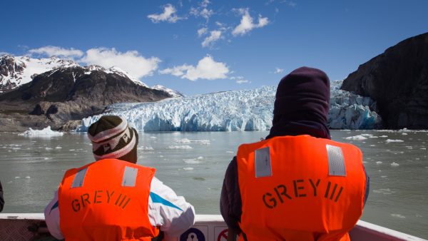
Yes, there are sailing trips (e.g., Lago Grey) and guided activities depending on the season and weather. Check with the Maritime Routes and authorized operators.
To enter Torres del Paine National Park, you must purchase your ticket in advance, preferably online. The official purchase is made through the CONAF platform — a pass sales system for protected areas — available at pasesparques.cl
If you need help with the payment process, some travel agencies—such as GreatChile—can help you with the purchase.
Once purchased, you will receive a digital ticket in PDF format with a QR code. When you arrive at the park, you must present this QR code (printed or on your cell phone), along with your ID—park rangers will scan it at the entrance.
Yes. Torres del Paine can be visited with children and elderly people, provided that the itinerary includes activities suited to their abilities. Although the park is known for its demanding treks, it also offers accessible alternatives such as:
Easy walks with nearby viewpoints.
Scenic drives with photo stops.
Boat trips and recommended family activities.
The key is to adjust the itinerary, stay hydrated, avoid exertion on windy days, and check the weather before each outing. Many visitors of all ages enjoy the park without having to undertake long or technical hikes.
Plan with real information, travel with experts. This guide is the result of years of exploring the destination. If our information has inspired you, we invite you to book your services with us. You'll not only be supporting this informative project, but you'll also have the backing of a team with direct contacts at the destination, ready to answer your questions and personalize your experience.

We carefully select every service and provide exclusive travel documents with practical tips for GreatChile clients.

We know the destination first-hand and maintain direct contact with our local partners to provide reliable, up-to-date advice.

We verify availability before payment and monitor every service before and during your trip to ensure everything runs as planned.